INFO@CATARAQUICEMETERY.CA
(613) 546-6545
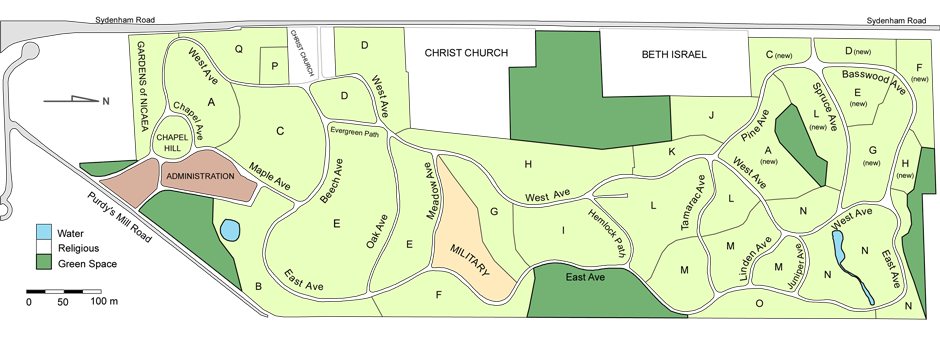
Map of Cataraqui Cemetery
Occupying an impressive 91 acres, Cataraqui Cemetery is a historic and heritage landscape. To help you navigate our cemetery, the map below illustrates for you the main roadways and paths. As you travel, please notice and take in the numerous vistas, gardens, artistic monuments and landscape features. Should you require assistance locating a specific site, you are welcome to contact our office during business hours (8:30am - 5:00pm Monday to Friday - excluding Holidays). The dark green areas on this map are open areas within the cemetery that are reserved for future interment sites, green space or cemetery needs.
The areas noted as "Christ Church" and "Beth Israel" are independent cemeteries for the congregations of those institutions and are not part of Cataraqui Cemetery. Please contact them directly should you have concerns or questions about those cemeteries.
We are pleased to introduce Cataraqui Cemetery and Funeral Services; the not for profit, simplified, convenient and inclusive approach to both cemetery and funeral arrangements. Families find peace of mind and value in that their cemetery, cremation, funeral and monument needs can now be served by one accommodating provider. Contact us to learn more about our services.
Click on the below map to download a printable version.